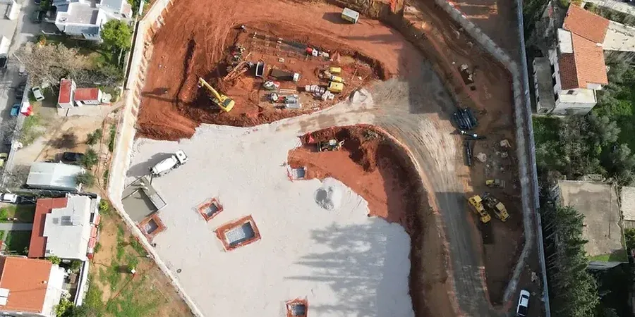
Lethbridge's urban growth has pushed development deeper into the Oldman River valley and onto the challenging Bearpaw Formation, where the history of coal mining and railway expansion left a legacy of disturbed ground. Designing a deep excavation here means confronting a layered subsurface that transitions sharply from stiff glacial till and clay into weak, moisture-sensitive bedrock. Every project below four meters in Lethbridge introduces lateral earth pressures on shoring systems that can surprise even experienced contractors. Our team approaches these projects by embedding the in-situ permeability testing data early into the shoring design, recognizing that perched groundwater in the till often dictates the difference between a dry cut and a prolonged dewatering operation. The city's position at 910 meters above sea level, combined with Chinook-driven freeze-thaw cycles, demands a design philosophy rooted in local stratigraphy rather than generic deep excavation manuals.
In Lethbridge, the transition zone between glacial till and Bearpaw sandstone at 6 to 12 meters is the critical design horizon for any deep excavation support system.
Process and scope
The near-surface geology across Lethbridge is dominated by the Pleistocene till — a dense, silty clay matrix with cobbles — overlying the Upper Cretaceous Bearpaw shale and sandstone. This contact zone, typically encountered between 6 and 12 meters depth, creates a classic two-layer geotechnical model for deep excavation design. The till provides excellent short-term stand-up time but is prone to slaking upon exposure to air and moisture. Below it, the Bearpaw sandstone behaves as a soft rock with unconfined compressive strengths often below 5 MPa, requiring careful selection of soldier pile spacing and shotcrete facing thickness. Our designs integrate a comprehensive analysis of active earth pressures on shoring walls, calculated per Rankine and Coulomb theories, and verified against the limit states outlined in the National Building Code of Canada. The presence of artesian conditions in certain valley-bottom locations around Lethbridge means no two excavation support designs are identical — we calibrate each model to site-specific pore pressure readings and pre-construction inclinometer baselines.
Local ground factors
With a population exceeding 100,000, Lethbridge continues to see multi-level underground parkades and utility vaults excavated within meters of century-old brick buildings in the downtown core. The 2013 southern Alberta floods, while less severe here than in Calgary, exposed how quickly the Oldman River's tributary ravines can saturate the upper till and trigger localized slumping. A deep excavation in Lethbridge's floodplain or coulee slopes carries a compounded risk: a shoring wall failure in saturated till can propagate into a progressive collapse of the adjacent street or buried infrastructure. We address this by specifying observational method protocols — installing vibrating wire piezometers and inclinometers before excavation begins, and defining trigger levels for contingency measures like additional tiebacks or toe berms. In the clay-rich till of north Lethbridge, time-dependent creep deformations can continue for weeks after the design depth is reached, making post-excavation monitoring as critical as the initial shoring design itself.
Relevant standards
NBCC 2020 (National Building Code of Canada) — Structural design provisions for excavations, CSA A23.3 — Design of concrete structures for shoring walls, ASTM D2487 — Unified Soil Classification System for till and clay characterization, CSA S6 — Canadian Highway Bridge Design Code (buried structures and MSE walls), ASTM D1586 — Standard Penetration Test for in-situ strength profiling, Alberta OH&S Code — Excavation and trenching safety requirements
Quick answers
What is the typical cost range for a deep excavation design in Lethbridge?
Fees for a complete geotechnical design package — including site investigation, shoring calculations, and monitoring specifications — generally range from CA$2,440 to CA$9,930, depending on excavation depth, proximity to adjacent structures, and the complexity of groundwater control required for the specific Lethbridge site.
How does the Bearpaw Formation affect shoring design in Lethbridge?
The Bearpaw Formation's sandstone and shale are moisture-sensitive and can degrade rapidly when exposed to air and water. Our designs account for this by specifying appropriate facing — typically shotcrete applied immediately after excavation of each lift — and by limiting the unsupported span in the sandstone layer to prevent spalling and progressive raveling behind the shoring wall.
What seismic provisions apply to deep excavations in Lethbridge?
Lethbridge lies in a region of low to moderate seismic hazard. We apply the seismic earth pressure provisions of the NBCC, calculating the incremental dynamic thrust on shoring walls using the Mononobe-Okabe method, and detailing connections accordingly to ensure ductile performance during a design-level earthquake.
How long does the design process take for a typical excavation?
A preliminary design can be ready within two to three weeks once the geotechnical site investigation data is available. The final, stamped design package, including all calculations and construction specifications, typically requires four to six weeks, though complex projects involving 3D finite element analysis of adjacent building interaction may extend this timeline.