← Home · Underground Excavations

Excavation Monitoring for Lethbridge’s Variable Ground Conditions

Together, we solve the challenges of tomorrow.

LEARN MORE →

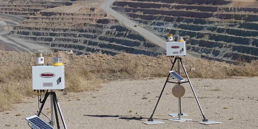
Part 4 of the National Building Code of Canada sets clear obligations for excavation safety, yet in Lethbridge the real challenge isn’t the paperwork—it’s the ground itself. The city sits at roughly 910 m elevation, perched above the Oldman River valley where surficial geology flips from stiff glacial till to soft, saturated lacustrine clay within a single block. When a contractor opens a cut deeper than 3 m in the river valley or through the city’s west-side coulees, we’ve seen ground movement that doesn’t match the textbook. Our team deploys automated total stations, in-place inclinometers, and vibrating-wire piezometers to track deformation in real time, feeding data back to the site trailer before a shift change. For projects where the excavation geometry is still being refined, deep excavation analysis helps establish baseline performance expectations against which field readings are compared.

In Lethbridge’s coulee terrain, monitoring isn’t just about compliance—it’s the only reliable way to catch moving ground before the trench box shifts.

Process and scope

Lethbridge’s near-surface stratigraphy is dominated by the Pleistocene till plain, but erosion from the Oldman River has carved steep-walled coulees where the till overlies Cretaceous bedrock. The water table fluctuates sharply between spring snowmelt and late summer, often rising within 2–3 m of grade in low-lying industrial parcels north of Highway 3. That matters because pore pressure response drives the difference between a stable cut and a wall deflection that exceeds the 0.5% H threshold cited in many shoring performance criteria. We instrument the excavation face with arrays that capture horizontal displacement at multiple depths, tying the readings to nearby benchmarks surveyed by static GPS. When the soil profile includes interbedded silt, a CPT test run before excavation lets us calibrate the monitoring threshold to the actual undrained shear strength profile rather than a generic assumed value, which is what makes the difference between a false alarm and catching a real problem early.
Excavation Monitoring for Lethbridge’s Variable Ground Conditions
Technical reference image — Lethbridge

Local ground factors

Lethbridge recorded a population of over 100,000 in the last census, and much of the recent growth has pushed site development onto the coulee slopes overlooking the Oldman River. These sites present a classic risk profile: a deep excavation into overconsolidated till that is crisscrossed by near-vertical joints left from glacial unloading. Water infiltrates the joints during the spring thaw, and within hours the apparent cohesion can drop enough to trigger a block failure behind the shoring. Without continuous inclinometer and piezometer data, the first visible sign is often a crack in the asphalt 10 m back from the wall—and by then the failure mechanism is already underway. The cost of monitoring a five-month excavation program is negligible next to the cost of rebuilding a collapsed soldier pile wall while a project sits idle for six weeks.

Need a geotechnical assessment?

Reply within 24h.

Email: info@geotechnicalengineering.xyz

Typical values

ParameterTypical value
Typical monitoring frequency (active phase)Hourly to daily, depending on deformation rate
Inclinometer casing depth1.5–2x excavation depth, socketed into bedrock where possible
Surface settlement point density5–10 m grid around excavation perimeter
Piezometer typeVibrating-wire, vented for barometric compensation
Crack gauge resolution0.1 mm across existing structures within zone of influence
Data deliveryWeb-based portal with automated alert thresholds per NBCC limits

Complementary services

01

Real-Time Shoring Performance

Inclinometers and load cells on tiebacks feed a dashboard that flags any anchor force loss or wall rotation exceeding the project’s pre-set alarm limits.

02

Groundwater & Pore Pressure Tracking

Vibrating-wire piezometers installed at multiple depths capture the rapid seasonal changes typical of the Oldman River basin, giving the superintendent time to adjust dewatering before the cut bottom softens.

03

Adjacent Structure Protection Surveys

Pre-construction condition surveys combined with automated crack monitors and optical survey points on neighboring buildings, particularly relevant for Lethbridge’s historic downtown masonry stock.

Relevant standards

NBCC 2015 (National Building Code of Canada) Part 4, CSA A23.3: Design of Concrete Structures, ASTM D7299: Standard Practice for Verifying Performance of Vertical Inclinometer Probes

Quick answers

At what excavation depth does NBCC require formal monitoring in Lethbridge?

The NBCC doesn’t set a single depth for all cases—it depends on the geotechnical design and the consequence of failure. In Lethbridge’s typical till, we usually recommend instrumentation once the cut exceeds 3.5–4 m if it’s adjacent to a public right-of-way or an existing structure. The engineer of record makes the final call based on the shoring design assumptions.

What’s the typical cost range for excavation monitoring on a Lethbridge project?

For a standard commercial excavation with a three-to-four-month monitoring period, the instrumentation and reporting package typically falls between CA$1,160 and CA$2,990, depending on the number of instrument stations, the frequency of readings, and whether automated data loggers are required.

How do you account for the rapid groundwater changes we see in spring?

We pair vibrating-wire piezometers with barometric sensors so we can separate atmospheric pressure swings from true pore pressure response. During the March–April melt, we can increase the sampling rate to capture the rising limb of the hydrograph within hours rather than days, which lets the contractor adjust sump pump locations before the excavation base is affected.

Can you monitor movement on an existing heritage building next to our excavation?

Yes. We carry out a baseline condition survey first, then install crack gauges on the most vulnerable masonry joints and set up optical prisms on the building corners. As soon as the excavation reaches the building’s zone of influence—typically the 1:1 line from the base of the cut—readings go to daily frequency and trigger a text alert if any tilt or crack opening exceeds the agreed threshold.

Location and service area

We serve projects in Lethbridge and surrounding areas.

View larger map